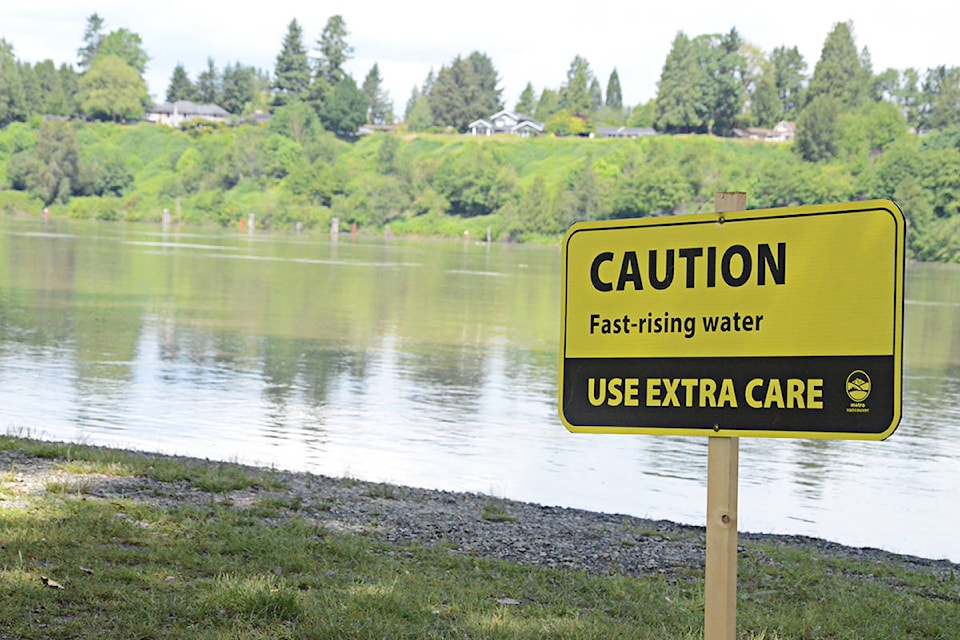
Water levels in the Fraser River through 91ԭ�� are high following the usual spring snowmelt and heavy rainfall in parts of B.C. over the weekend.
On Sunday, the water levels peaked in the morning at more than 5.2 metres, before falling again on Monday to below 5.1 metres, but the water could rise again based on projected weather conditions.
According to Roeland Zwaag, the Township’s director of public works, the next step if water does keep rising is to send out alert letters to people living in potential flood zones.
“The next threshold happens at 5.5 metres,” Zwaag said.
91ԭ�� Township is asking people who live along the the river in low-lying areas to have a plan in place if they need to leave because water levels rise further.
Advice includes making a plan to stay with family or friends, have an emergency kit packed with clothes, medication, and other necessities, and ensure a meeting place if families are not together when an evacuation order comes.
The Township has also stocked up on sandbags and is doing weekly patrols to check the stability of the dikes along the river. If the water level rises, those patrols become daily.
High water has impacted 91ԭ�� several times in recent years, most recently in 2018, when the level at the Mission gauge reached 6.0 metres and low-lying areas, particularly outside the dikes near Fort 91ԭ�� and in Glen Valley, were underwater. Volunteers sandbagged vulnerable homes and buildings on the local Kwantlen and Katzie First Nation reserves.
If water rises above 5.5 metres and reaches closer to 6.0 metres, it can flood low-lying fields, cut off foot paths in parks along the river, and even cause road closures along places such as Allard Crescent, 208th Street, and River Road.


